With the imminent arrival of El Niño, many of these mammals could become trapped as water bodies shrink or even die. At least 120 fishers from nine local associations in the Middle Magdalena region carry out ongoing community monitoring to enable a timely response to potential emergencies. The effort covers at least 33 water bodies and six wetland complexes. To date, they have logged more than 8,076 hours of monitoring, while also supporting the regional Manatee Stranding Network.
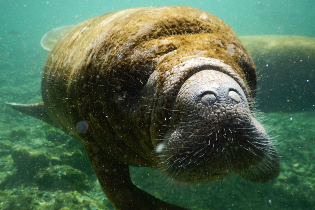 Photo: Katherine Arevalo-Gonzalez
By Javier Silva
Declining water levels in rivers and wetlands across the Middle Magdalena region, particularly around Barrancabermeja in Santander and Aguachica in Cesar, have raised alarm among local authorities and communities over the future of Caribbean manatees (Trichechus manatus manatus).
This species, classified as Endangered in Colombia’s Red Book of Mammals, is particularly vulnerable to declining water levels. For manatees, shrinking water bodies mean much more than simply having less room to move. Wetlands function as a network of corridors that allow them to move between rivers, streams, and other wetlands where they find food and shelter. When these corridors become too shallow or are cut off, some manatees can become isolated or stranded and may even die without human assistance.
The regional situation is already concerning, even though El Niño has not yet reached its peak. According to Colombia’s Institute of Hydrology, Meteorology and Environmental Studies (IDEAM), its effects are expected to be felt most strongly between October and December.
According to the institute, the Magdalena River around Barrancabermeja is currently at between 1.40 and 1.45 meters, almost one meter below the level normally recorded at this time of year, with critical points where it barely reaches 70 centimeters. Some areas of the Paredes and El Llanito wetlands are already almost completely dry, making navigation difficult for fishers.
Against this backdrop, two manatee conservation strategies are strengthening their efforts to anticipate and respond to potential emergencies: community monitoring by local fishers and the Manatee Stranding Network (RVM, for its Spanish acronym).
Community Monitoring
Pilar Aguirre, Monitoring Specialist at WCS Colombia, explains that community monitoring has become particularly important because it helps identify where manatees are, which routes they use, and which animals could become isolated or stranded if connectivity between rivers, streams, and wetlands is lost.
The strategy currently involves around 120 fishers organized into local associations, most of them in Barrancabermeja (Pezcomagda, Apacco, Asopezchucurí, Asodesba, and Asopezgrum). There are also fishers from Bocas del Carare, a rural community in Puerto Parra (Asopesbocar); Campo Duro, in Puerto Wilches (Asopromanatí); and Sabana de Torres (Proecomanatí). In Cesar, the Asociación de Hombres Pescadores y Agricultores de Campo Amalia brings together fishers from Campo Amalia, a rural community in Aguachica.
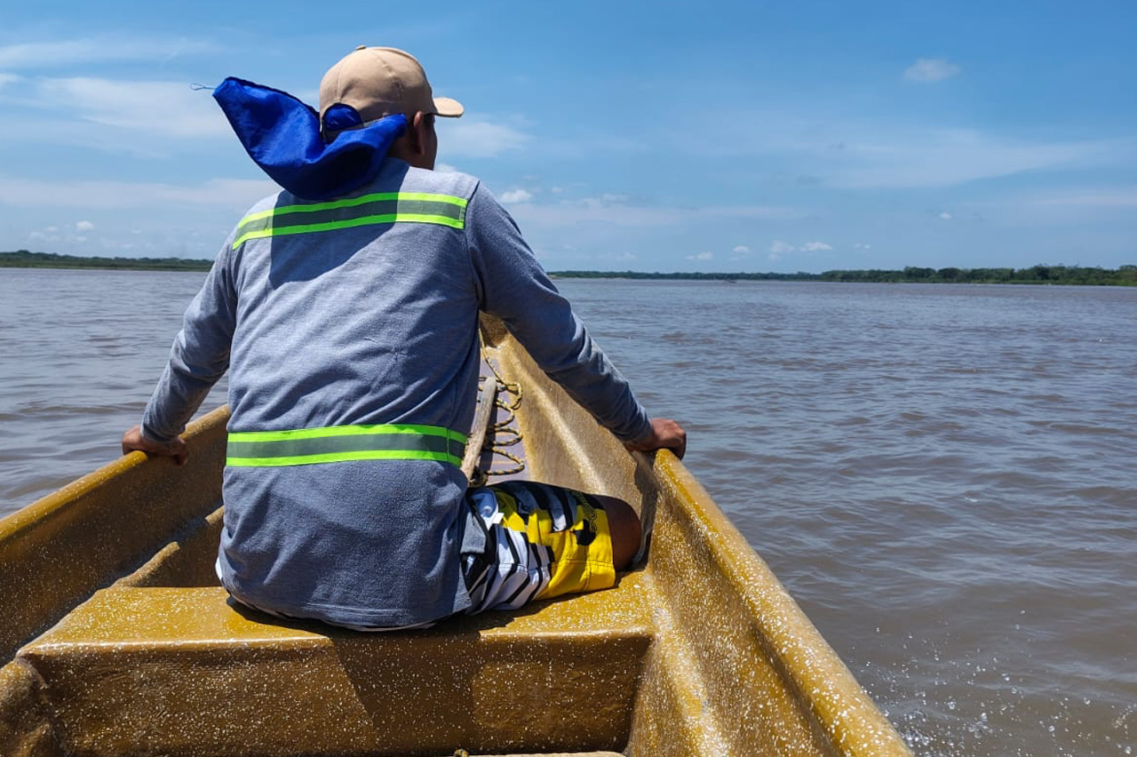 Photo: Yelsin Salgado / WCS Colombia
Pilar says that, to date, local participants have logged more than 8,076 hours of monitoring.
The work covers at least 33 water bodies and six wetland complexes near the Sogamoso, Opón, Magdalena, Lebrija, Viejito, San Juan, and Carare rivers, as well as the Opón, Peruétano, La Colorada, Macías, Parirí, Chucurí, and Paredes wetlands.
All participants were trained by the WCS team through Proyecto Vida Silvestre (PVS)* to collect information and complete a monitoring form that records, among other details, the date, time, and location of each fishing trip and whether a manatee was sighted. Even when there are no sightings, participants record that information, which is then technically validated.
When one or more manatees are sighted, fishers record how many animals they saw, where they were, whether they appeared large or small, and what they were doing at the time—swimming, feeding, mating, or experiencing an emergency. Because manatees rarely emerge completely from the water, fishers also record which parts of the animal they were able to see.
Only Noses, Backs, and Tails
The monitoring effort has so far comprised two stages. The first ran from March 2024 through the first quarter of 2025. The second phase is currently underway and has covered all of 2026. In total, fishers have completed 1,887 monitoring forms, documenting 1,357 sightings. The data indicate that manatees have been sighted most frequently in the Carare, Viejito, and Lebrija rivers, as well as the Paredes and Parirí wetlands and Macías and Peruétano creeks.
Pilar Aguirre adds that fishers have generally been able to see only parts of larger animals, such as their tails, noses, and backs. More often, however, they detect the animals surfacing—when manatees briefly raise a few centimeters of their bodies above the water. Within seconds of sensing a canoe or human presence, they churn the water as they dive back down and disappear from view.
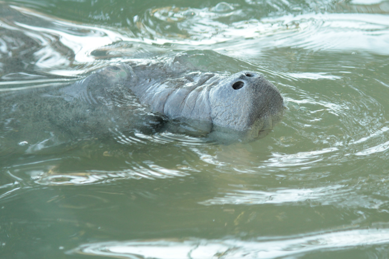 Photo: Katherine Arevalo-Gonzalez
The information is collected by fishers and a group of volunteer monitors, who upload it to KoboToolbox, a mobile platform designed for collecting and analyzing field data. WCS professionals then consolidate and analyze the information and provide feedback to the monitors.
One of these monitors is Carmen Chiquillo, who lives in Campo Amalia, a rural community in Aguachica, Cesar, on the banks of the Lebrija River. She has been collecting data for at least a month, but so far the fishers who report their observations to her have not seen any manatees.
“The river level is very low, and they have had to turn to other activities to make a living because going out fishing isn’t worth it. There’s no way to make a catch in a river that is almost dry,” Carmen says. She is concerned that some of the manatees seen near her community could become stranded.
She recalls a similar case about seven years ago, when, during another dry season, three females and a male calf became stranded in a nearby wetland.
“People gave them food, especially plants. Many even measured them, and eventually everyone helped carry them on fabric stretchers to another wetland very close to where they had become trapped,” Carmen recalls.
She says current conditions could lead to a similar situation, which is why residents of the community, despite their own challenges, are keeping a close watch.
The Manatee Stranding Network and an Emergency Hotline
At the end of July, a group of fishers found a stranded manatee on Modesto Island, in the Campo Duro area of Puerto Wilches, Santander, in the Paredes wetland. Just as they were preparing to rescue it by hand, it began to rain. The downpour did the work for them: the water level rose enough for the animal to leave the island on its own.
But they are not always so lucky. That is why WCS and the Cabildo Verde Foundation of Sabana de Torres, partner organizations in the PVS, are strengthening support for manatees during this season through another strategy: the Manatee Stranding Network (RVM). The Network receives reports from local residents and officials when a manatee becomes trapped, stranded, or exposed in a dry area.
Katerin Arévalo González, a biologist specializing in manatees and coordinator of the Network, explains that, as of last year, the RVM had received reports of 58 strandings. This category includes cases in which animals become trapped in isolated pools or are stranded and left exposed in dry areas, either because they become disoriented or because the water recedes.
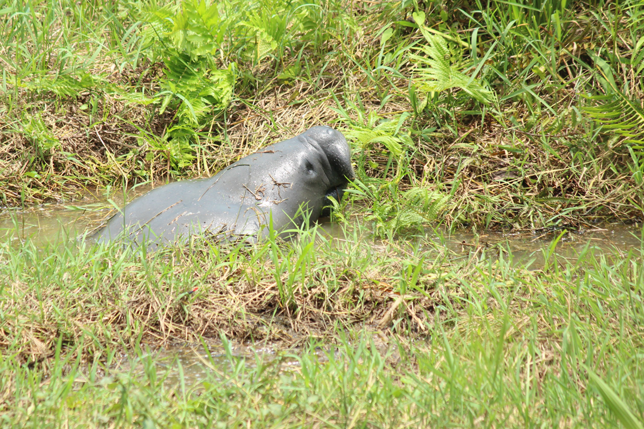 Photo: Katherine Arevalo-Gonzalez / Cabildo Verde Sabana de Torres
“One of the Network’s main contributions is that, even when one of its members cannot immediately assist a manatee in distress, it can mobilize institutions and secure the necessary support,” Arévalo explains.
The Network operates primarily through an emergency hotline (322-9838738), which anyone can call to report a manatee in distress and even send photographs via WhatsApp. Once a report is received, the Network’s operational team determines what action is needed and, depending on the location, identifies the experts who should lead the response.
The Network is supported primarily by the Santander Regional Autonomous Corporation (CAS), which maintains an emergency response protocol and coordination mechanisms with Cabildo Verde and WCS, as well as with organizations such as Corantioquia and Corpocesar and municipal governments including those of Barrancabermeja, Yondó, Sabana de Torres, Puerto Wilches, and Puerto Parra. CAS also conducts inspections of animals that are found dead.
A key pillar of the Network is ensuring that local communities have effective communication channels with the relevant authorities so they can report emergencies. So far, nearly 90 percent of all reports have come from local communities.
Residents of rural communities such as El Totumo and El Descanso (Yondó, Antioquia), Riberas del San Juan (Cimitarra, Santander), Bocas del Carare and La Sierra (Puerto Parra, Santander), and Campo Amalia (Aguachica, Cesar), as well as people living near wetlands such as Paredes, between Puerto Wilches and Sabana de Torres in Santander, have also been trained by the participating organizations to provide basic first aid. This includes helping relocate an injured or stranded animal to a place where it can be kept wet or providing shade if it is found out of the water while further assistance is arranged.
The PVS is also preparing a pilot program to introduce another monitoring form designed to generate early warnings, with real-time information on manatee sightings, river and wetland water levels, access conditions, the presence of dead fish or other animals, and potential loss of connectivity between wetlands.
This information will complement the work of the Manatee Stranding Network and strengthen its capacity to respond to potential emergencies, particularly in areas where drought conditions may make access difficult.
The Ecological Importance of the Caribbean Manatee
The need to strengthen these strategies is not simply a response to a drought whose consequences are still difficult to predict. For manatees, this is yet another threat in a long history of challenges to their survival.
For decades, hunting for meat led to the deaths of numerous individuals and contributed to population declines. In recent years, this pressure has been compounded by habitat transformation: wetlands and other water bodies have been drained or altered for agricultural activities, including crop production and livestock farming—even buffalo ranching—reducing the routes manatees have historically used to feed, find shelter, and move between habitats.
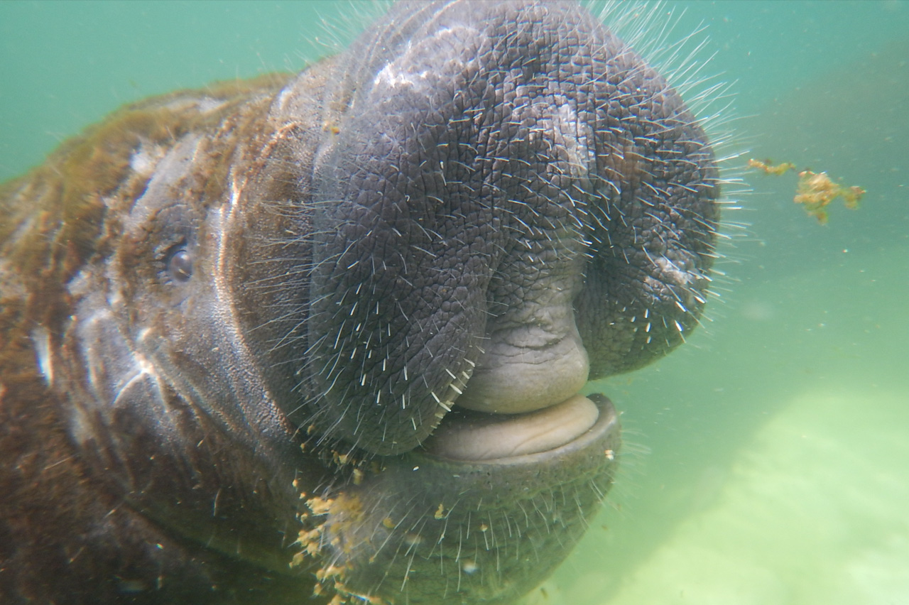 Photo: Katherine Arevalo-Gonzalez
Their waters are also affected by pollution from illegal gold mining and solid-waste dumping, while large fishing nets known as gillnets pose another threat: manatees can become entangled in them and drown
The PVS works to protect a species that plays an important role in aquatic ecosystems. By feeding on aquatic plants, for example, manatees help control the growth of species such as water hyacinth—which is why they are sometimes called “aquatic cows.” When these plants proliferate excessively, they can reduce the amount of oxygen available in wetlands, streams, and rivers.
Manatees also stir up sediment through their movements and flipper strokes, contributing to the maintenance of water-body depth. Their feces, meanwhile, provide nutrients that serve as food for fish.
Ensuring that manatees have the conditions they need to survive is therefore essential, even amid the climate crisis. Otherwise, as the years go by, people who share their territory with these mammals may no longer be able to repeat with the same confidence a familiar saying that many invoke almost as a good omen: “Where there are manatees, there will surely be good fishing.”
*Proyecto Vida Silvestre (PVS) is an initiative led by Ecopetrol, Fondo Acción, and WCS Colombia that works to conserve 15 species—12 animal species and three plant species—across three landscapes: the Eastern Plains, the Middle Magdalena, and the Andean-Amazonian foothills in Putumayo.