 Llanos Seasonality
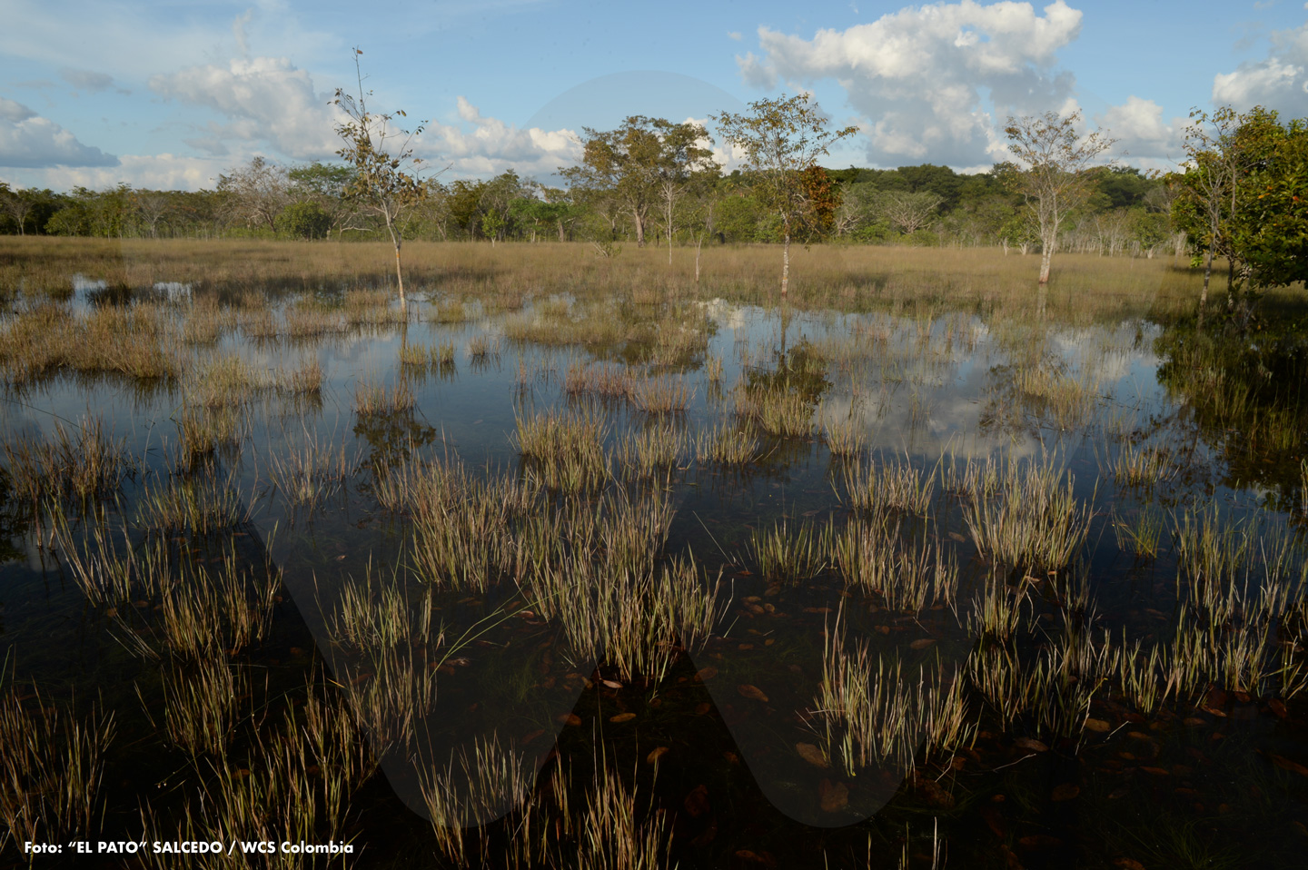
The Eastern Llanos experience, year after year, two opposing climatic seasons: a dry season, which generally begins in December and lasts roughly until March; followed by the onset of heavy rains that extend approximately until the last weeks of November or the first weeks of December. The image shown here, from the Bita River basin, depicts flooding caused by the rainy season in a small strip of savanna. In just a few months, with the arrival of the dry season, the floodwaters will recede, and the area will begin to endure the harsh conditions of drought and heat.
 The Beaches of the Meta River
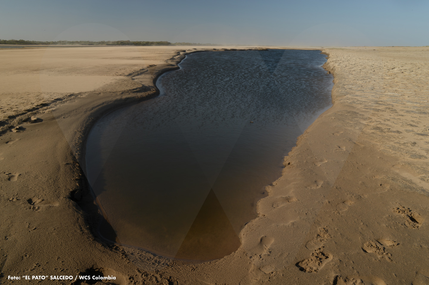
Let’s continue with the marked seasonality of the Llanos climate. During the months without rain, most of the large rivers that flow through this region reveal vast beaches that emerge due to the pronounced drop in water levels. This is the case of the Meta River, which here shows us a small pool trapped by a giant summer beach. The scene was captured very close to Santa María la Virgen, a beautiful rural community in the municipality of Cravo Norte, Arauca department. Months will pass, and with their arrival, the rains will come, flooding all this and much more.
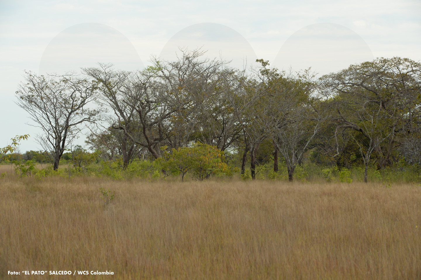
 The Bita River
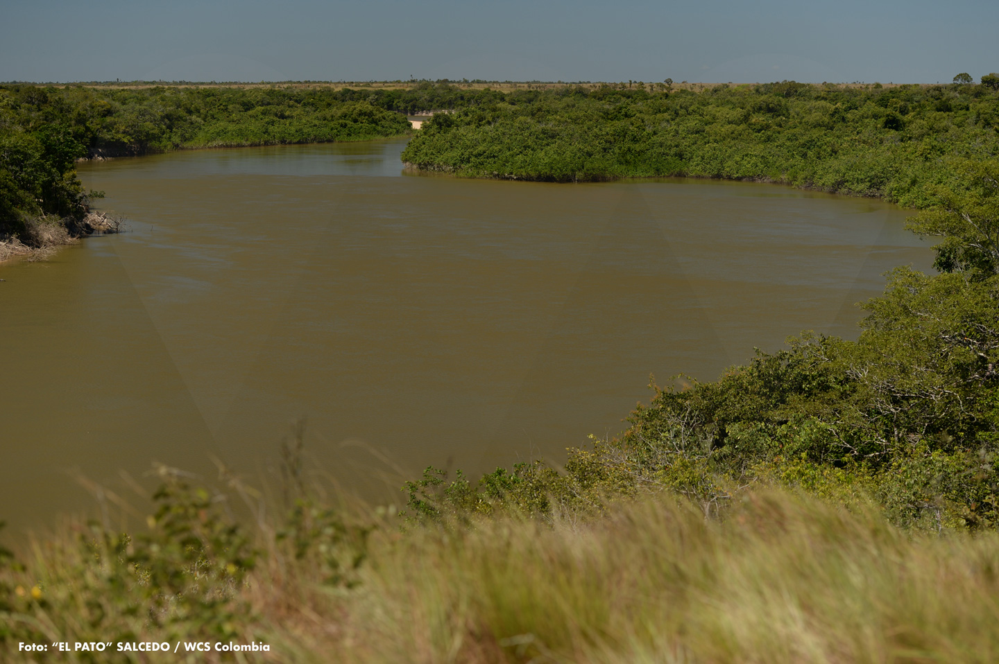
It is both born and ends its journey in the department of Vichada. Its headwaters, located near the municipality of La Primavera, form an extensive and beautiful landscape where estuaries, moriche palm groves, and typical Orinoquía forests converge. From there, the Bita flows for nearly 600 kilometers until it meets the waters of the Orinoco River, near the municipality of Puerto Carreño. Based on the Ramsar Convention, the entire watershed of this river was declared a wetland of international importance in 2018—a well-deserved recognition for the beautiful and vitally important Bita River.
 Wrinkled Llanos
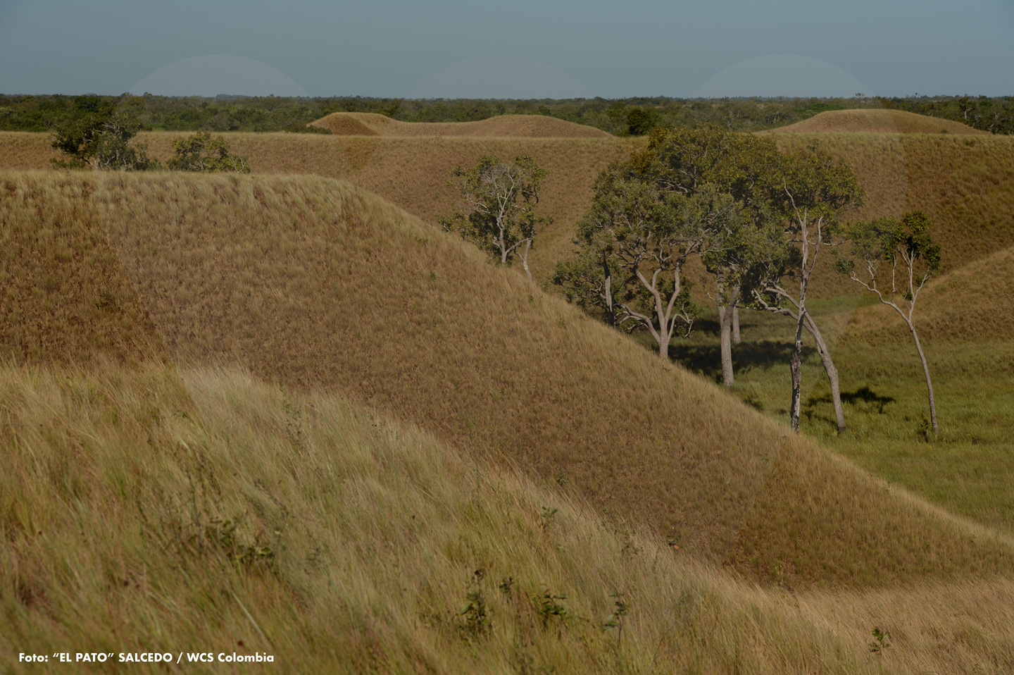
When we hear or read the word Llanos, many of us may picture vast, flat plains—uniform landscapes seemingly uninterrupted by hills or undulating forms. However, that assumption quickly fades when we come across places like the one shown here. Located adjacent to the Bita River, this hilly terrain, part of the river’s lower basin, reveals the sinuous character that certain corners of the Orinoquía can possess. To get a sense of the size of these terraces, take a closer look at the height and stature of the trees that have managed to survive in the lower part of this wrinkled landscape.
 The Congriales
One of the many species supported by the PVS is the congrio tree. Scientifically known as Acosmium nitens, this tree is distributed from Colombia to Brazil. Its high-quality wood has made it highly sought after, especially for use as fence posts in pastures or as support beams in construction. Congrio typically grows in areas that local people refer to as bajos—low-lying lands that remain flooded during the rainy season. In these conditions, the species thrives so well that, over the years, it comes to dominate the landscape. That is why these patches of savanna are known as congriales, which is exactly what we see in this photo.
Traslated with AI support