Helping to protect key natural landscapes
WCS's commitment to conservation areas is reflected in its ongoing dedication to protecting the natural and cultural values safeguarded within them. This includes the financial and technical support we provide to designate new conservation zones or to assist existing ones with technical guidance for effective management and governance.
To date, we have prioritized key sites for conservation and effective management. This includes new public and private protected areas, OECMs, and ethnic territories.
Additionally, we support public institutions in leveraging technology for information management on pressures, threats, and biodiversity within national and regional protected area systems.
In 2024, we identified more than 50 sites of importance for biodiversity conservation, six of which are currently undergoing the process of designation as public protected areas. Another 20 are in the process of being designated as Civil Society Nature Reserves, while 27 have been prioritized as OECMs—11 of which are in the process of being officially reported to the Ministry of Environment, covering a total of 12,483 hectares.
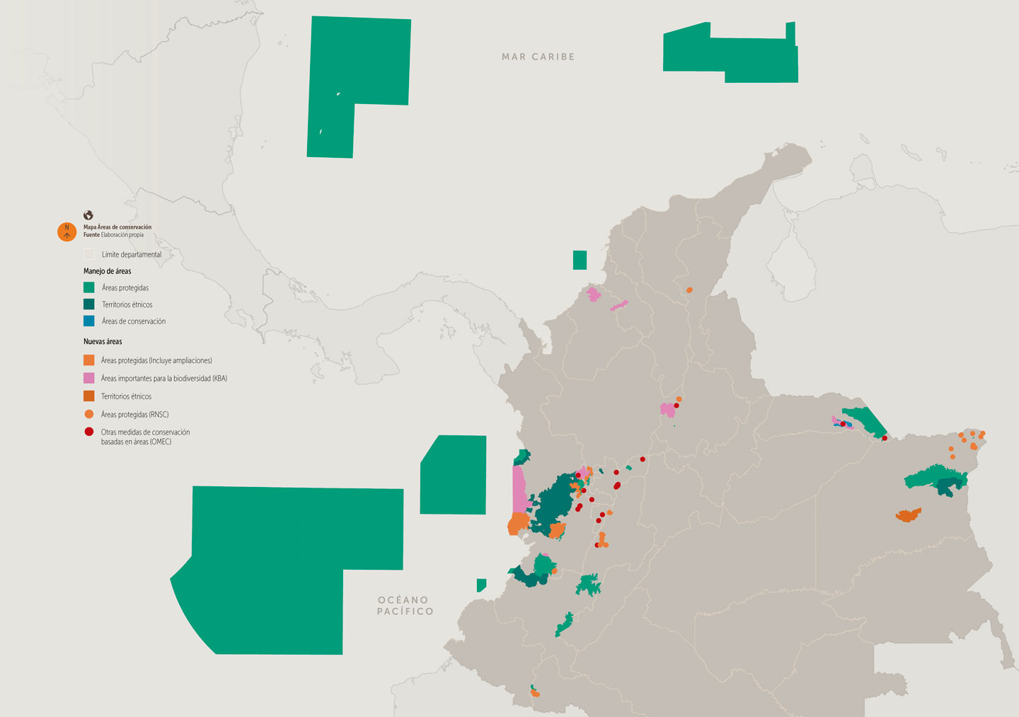
Additionally, 20 conservation areas are part of management actions, including conservation agreements, biodiversity monitoring, and support for ethnic territories. These efforts encompass ecological restoration processes and the development of planning instruments for their territories.
Specifically, regarding ethnic territories, support has been extended to six Indigenous reserves through the development of their life plans and the monitoring of biocultural values, among other actions. Similarly, at least 10 community councils have received assistance in designing their planning or administrative instruments, conducting socio-economic, cultural, and environmental assessments, and voluntarily signing conservation agreements.
Furthermore, we have contributed scientific information to inform the designation criteria for Key Biodiversity Areas (KBAs)—sites of critical importance for habitat conservation and unique species populations. By designating KBAs, we can develop management strategies to safeguard the largest and most significant populations of species at risk due to habitat degradation. Identifying these geographically restricted sites is crucial, as they face threats from unsustainable human activities. KBAs can also serve as a tool for governments to guide the expansion of protected areas, ensuring the inclusion of vital and relevant locations.
WCS also supports the implementation of SMART technology (Spatial Monitoring and Reporting Tool) in these areas. This tool facilitates the generation and sharing of useful data between conserved areas, the regional and central offices managing them, and other national environmental entities.
Additionally, SMART helps identify whether a conservation area is being affected by factors such as cattle ranching, improper solid waste management, or unregulated tourism. With this real-time data, authorities can effectively plan new prevention, surveillance, and control patrols while generating biodiversity monitoring data for conservation areas.
We have implemented SMART across the entire National Natural Parks system, as well as in regions where the Regional Autonomous Corporation for the Sustainable Development of Chocó (Codechocó) and the Regional Autonomous Corporation of Risaralda (CARDER) operate. Additionally, it has been used in certain areas of the Amazon and Caribbean regions and within Afro-Colombian community councils, strengthening local conservation capacities and promoting sustainable development within these communities.
Translated with AI support