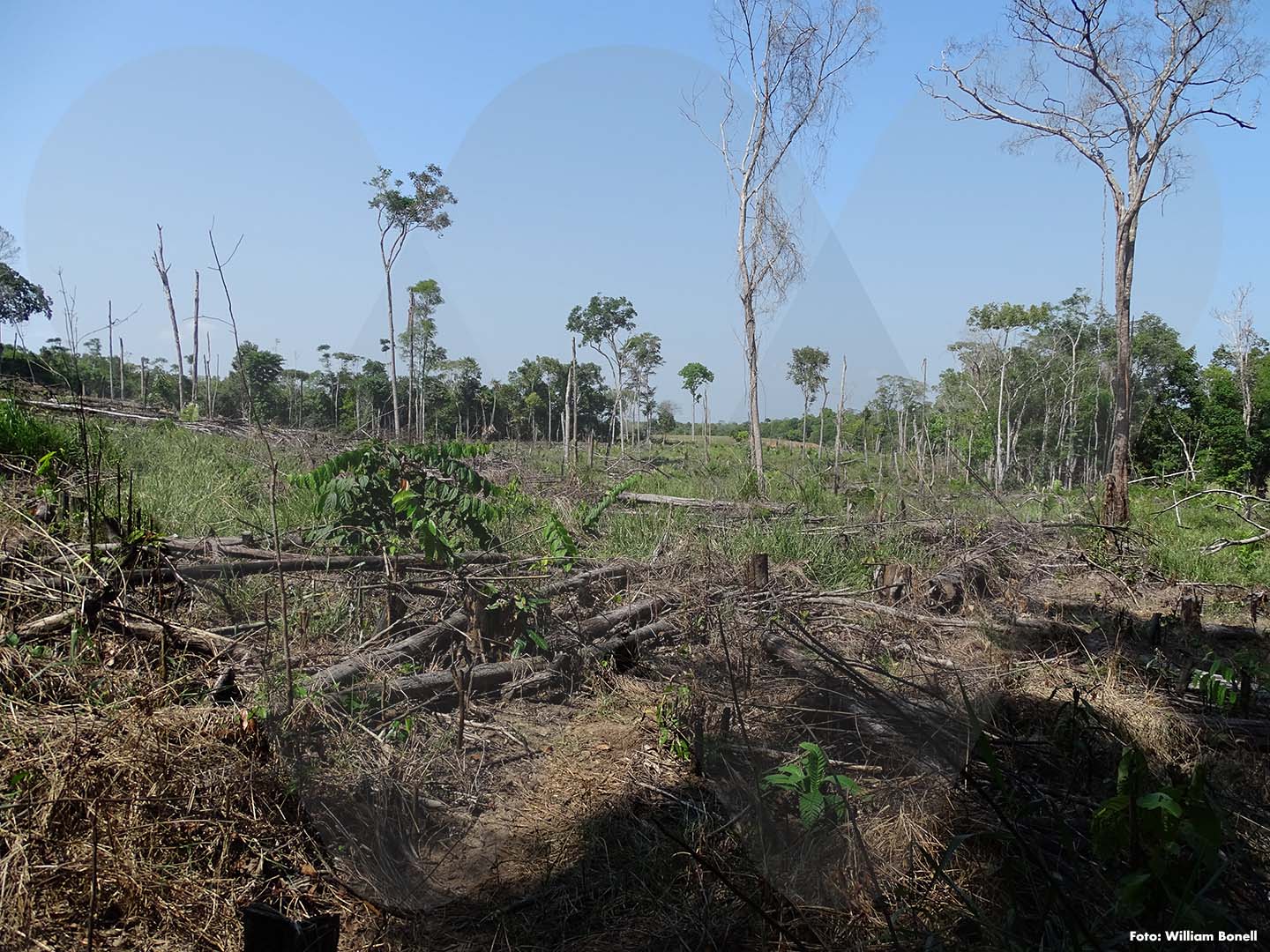
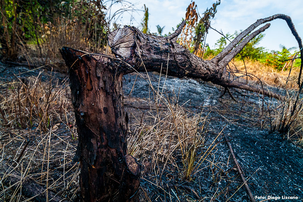
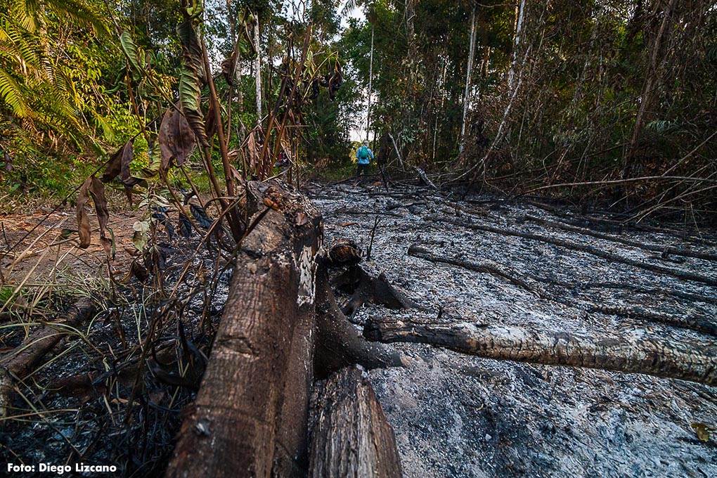
The destruction of forests within Natural Parks and other national reserve areas grew 177 percent after the peace agreement was signed. So says a study that analyzed the condition of 39 of these preserved territories, recently published by the Scientific Reports magazine.

Before the government of Juan Manuel Santos signed the peace agreement with the FARC guerrilla on November 24, 2016, analysts and experts always warned of the dangers that natural resources could face when the war ended. It was said, for example, that deforestation could increase when the armed group fronts were no longer present in the country’s forests or jungles, mainly in the Orinoquía and Amazonía regions, smoothing the path for the arrival of a new ‘colonization’ of these territories.
And the hypotheses, bit by bit, have given way to evidence: one of them is a study recently published by the Scientific Reports magazine of the Nature publishing group that reveals that the loss of forest resources, in Colombia's Natural Parks and national reserves, as well as in their buffer zones or bordering zones, has increased during the post-conflict.
The researchers, led by Nicola Clerici, PhD in Ecology and professor at the Universidad del Rosario of Bogotá, and among which were Peter Kareiva Director of the Institute of the Environment and Sustainability at the University of California and Germán Forero, Science Director at WCS Colombia, considered the deforestation registered in 39 national protected areas before the peace agreement was signed (between years 2013 and 2015). And they then observed the behavior of this phenomenon in the same territories between 2016 and 2018, the first three years of the post-conflict.
One of the conclusions states that, in 31 of that total number of areas, there was an obvious increase in deforestation rate between the two periods considered. The increase reached 177 percent, which implied a loss of 330 square kilometers of forests that, paradoxically, were protected in the midst of the internal confrontation.
A million pesos per hectare
For example, in the National Park Serranía de La Macarena (Meta), deforestation before the demobilization of the FARC rebel group was 41 square kilometers. This figure rose to 91 square kilometers between 2016 and 2018.
Nicola Clerici had the opportunity to visit this National Park and observed intentional fires promoted by people who wanted to take possession of the land for subsistence agriculture. “They even told me hectares were available for sale, at one million pesos each”, he says.

This is not the only place where destruction is unsettling. In the National Park Tinigua (Meta), a link with other key regions such as Sumapaz and the Cordillera de Los Picachos, in Caquetá, the destruction of the forest reached 37 square kilometers before the armed conflict was put to an end. But three years after the laying down of weapons, logging began to cover 159 square kilometers. And in Catatumbo Barí (Norte de Santander), to mention another protected area, the loss of vegetation increased from 11 to 55 square kilometers.
Other national reserve zones where the loss of natural resources increased were: National Park La Paya (Putumayo), where it rose from 23 square kilometers during the conflict to 34 after the peace deal; Natural Reserve Nukak, between Guaviare and Vaupés (from 9 square kilometers to 19), as well as National Parks Paramillo, between Córdoba and Antioquia (from 19 to 48 square kilometers) and Sierra Nevada de Santa Marta in Magdalena (from 7 to 30 square kilometers).
This pattern of loss of forest resources was also observed in the buffer zones or sites 10 kilometers away from park limits and national reserves, the majority located in remote areas, removed from the cities, where there was an increase of 158 percent in the conversion or transformation of forests.
This was more evident in the National Park La Macarena, where deforestation in its adjoining zones went from 103 square kilometers to 287 square kilometers. A similar situation was confirmed in National Parks La Paya (from 72 to 121 square kilometers), Paramillo (from 26 to 78), Picachos, between Caquetá and Meta (from 9 to 55), Pisba, in Boyacá (from 0.4 to 2.9 square kilometers) and Serranía de los Yariguíes, in Santander (from 2 to 15 square kilometers).
In the post-conflict, deforestation only decreased in National Parks Tayrona (Magdalena), where there was a reduction of 98 square kilometers; Macuira (La Guajira), with a reduction of 79 square kilometers and Los Nevados, between Tolima and Caldas, with a decrease of 46 square kilometers.
“A first conclusion is that peace is not the cause of deforestation. The departure of the armed groups that controlled the territory simply exacerbated and unleashed the true historical, systemic factors that affect the territories where these protected areas are located”, points out Germán Forero, Science Director at WCS Colombia.
Announced disaster
It is not a strange or unprecedented occurrence for the environment to be the main victim after an agreement that puts an end to an armed conflict. Situations, similar to the Colombian one, have been reported in countries such as El Salvador, Nicaragua, Guatemala, Democratic Republic of Congo, Rwanda and Uganda.
“The causes related with this increase are not part of new dynamics; they are the same ones (livestock farming, agriculture, illicit crops, land theft), intensified by the departure of the FARC and the consequent power void, of which the colonization has taken advantage”, explained Nicola Clerici.
There are some recurring causes that give way to the emergence of these activities with no limitation. Mainly, adds Clericci, the lack of institutional capacity in Colombia to enforce laws and to manage the use or the protection of natural resources, plus the financial, technical and operative weakness of the country to establish a register of illegal occupation of lands and a low capacity to recover them, when they are illegally seized.

For example, one of the considerations of the document indicates that the National Government was unable to guarantee a functional institutional presence in several protected areas, after the peace agreement. And, consequently, pressures such as the illegal extension of agriculture, livestock farming and illicit crops progressed and were consolidated in or around some of them.
“It is evident that, for the State, the creation of protected areas has been a priority, which is very good. But it is a decision that has not been supported or complemented with adequate budgets to protect them from the frequent environmental crimes that occur in them”, added the expert.
The study used a deforestation database that took advantage of Landsat satellite images and considered reports of the United Nations Office on Drugs and Crime (UNODC) that stated that illicit coca crops within protected areas increased four percent between 2016 and 2017, reaching 83 square kilometers. Two thirds of these crops were concentrated in National Parks Serranía de la Macarena (28.3 square kilometers) and Paramillo and in the Nukak Natural Reserve.
An analysis was also made of National Natural Park Chiribiquete, perhaps the most important in the country and declared World Heritage Site. And, although it did not register a significant increase in its deforestation data (it went from 3.6 square kilometers before the peace agreement to 3.8 in the post-conflict), it merits a final thought: “it is not a very serious increase, but we are concerned about the deforestation spots that are already emerging in certain parts of its northwestern and northeastern polygon”, commented Clerici.
**
Dolores Armenteras, biology professor of the Universidad Nacional de Colombia; Claire Hirashiki, of the Institute of the Environment and Sustainability at the University of California; Rodrigo Botero, Director of Fundación para la Conservación y el Desarrollo Sostenible; Juan Pablo Ramírez, of the Instituto de Hidrología, Meteorología y Estudios Ambientales (Ideam); José Manuel Ochoa, Carlos Lora and Carlos Gómez, of the Instituto Alexánder von Humboldt; Laura Schneider, of the Geography Department at Rutgers University, en New Jersey (U.S.A.), Mauricio Linares, professor at the Universidad del Rosario and Duan Biggs, of the Department of Conservation Ecology and Entomology at Stellenbosch University in South Africa also participated in this investigation.